I attended the April 10, 2025, Camden County Commission meeting at 10:00 a.m.
All commissioners were present.
The first agenda item was “Surplus Funds Request.”
A request for $84,035.61 had been reviewed by the County Attorney and the Treasurer.
This request was approved unanimously by the Commission.
The second agenda item was “Annual GIS Limited License Agreement.”
This was a license agreement to allow Wes Grant to have limited use of the county’s GIS information.
It was approved unanimously by the Commission.
The third agenda item was “HSBSRD Road Impact Fees.”
(Gadfly explanation: The county’s current road impact fee ordinance was signed in 2018. It really avoids the words “impact fees” and calls them road development charges instead.
It established a road development charge per square foot that varied depending on the zoning of the property. This would be charged when people applied for P&Z permits or approvals. Construction road charges outside of the Planning and Zoning District would be determined on a “case by case basis.” The ordinance specifies that it does not apply to the Horseshoe Bend Special Road District.
The impact fees are to be collected and distributed into “Road Sub-District Service Areas.” The intent was that the impact fee money would only be spent in the Service Area where the new construction occurred. After 10 years, if the money had not been used for roadwork, the builder could apply to have their road impact fees returned to them.
It seems like most of the impact fee money was never spent and simply accumulated in the deposit account. By the beginning of 2024, the total impact fee money had reached $1,295,419.05.
Some of that money was recently allocated to pay $500,000 for the new Willow Creek Bridge.)
A representative from the HBSRD explained that the exemption for the HBSRD has created some problems. While the Four Seasons POA has a mechanism for collecting road impact fees, those road district areas that are not within the POA are not paying those fees and several large construction projects on Horseshoe Bend have had a significant impact on the road district’s roads.
Commissioner Gohagan wanted to amend the ordinance to allow the HBSRD to collect impact fees within its boundaries. After a discussion, it was decided to continue to have the Planning and Zoning Department collect the road development charges during the application process. They would now also collect the fee for the HBSRD.
A transfer of a portion of the previously collected impact fees to the HBSRD was discussed, but Commissioner Dougan wanted to take a closer look at the funds before he would agree to that.
Presiding Commissioner Skelton stressed that the county needed to ensure that the impact fees were set aside based on the appropriate road sub-districts from now on.
The Commission voted unanimously to amend the Road Development Charge Ordinance to remove the exception for the Horseshoe Bend Special Road District, allowing the district to collect those fees going forward.
In Old Business, several upcoming projects were considered.
The County Jail showers still need to be repaired and the project will require a lot of planning since it will have to be undertaken while the jail is operating. The Maintenance Department will have to meet with the Sheriff’s Office to determine what the project bid is going to require.
Camden County will also need to purchase a new generator for the Sheriff’s Office and the Court Building. It’s going to cost approximately $360,000 for a 600 Kw generator. It would be built to order and the county would have to put down a significant deposit. The new generator would have more than enough power to run the two buildings and the current generator is on its last legs.
Commissioner Gohagan stressed that the new generator was a “huge need” for the county. Auditor Laughlin explained that the money for the generator would have to come out of the county’s contingency fund.
Commissioner Gohagan asked Laughlin if he had set up the LEST trust account for the Sheriff yet?
Laughlin responded that he was he had been busy working with the Sheriff on his department’s shift differential pay. He felt he could have the LEST trust account set up by mid-May.
In Public Comment, some residents spoke before the Commission about an issue they are having in their neighborhood.
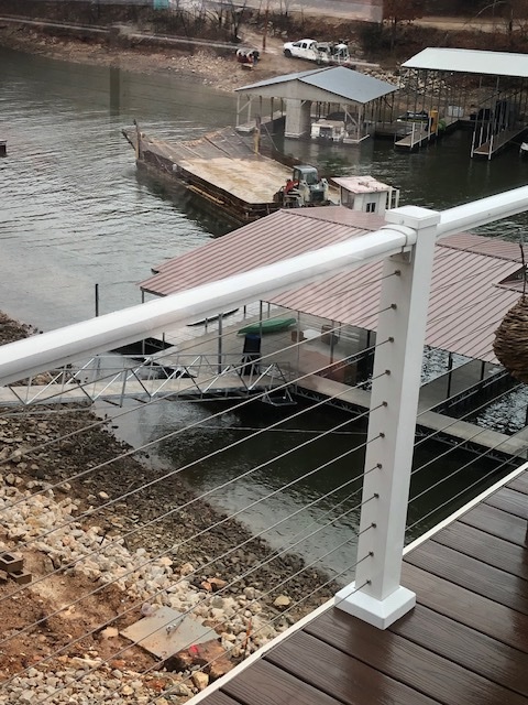
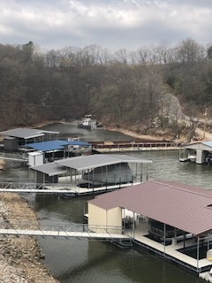
John Ligouri spoke on behalf of the six homes that are located on Waterside Drive. They are in a small cove they share with Pier 31. David Krehbiel was also present with a thick file of maps and documents.
According to these gentlemen, there is a stretch of land where what used to be old Highway 5 dead ends into the lake. This land is on the opposite side of the cove from their six residences and their docks.

roofed dock.
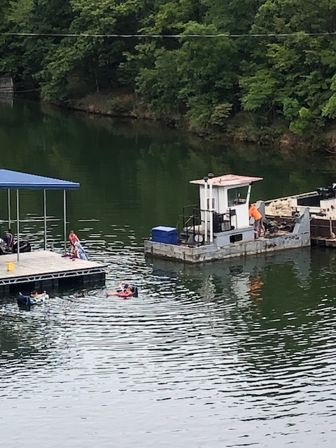
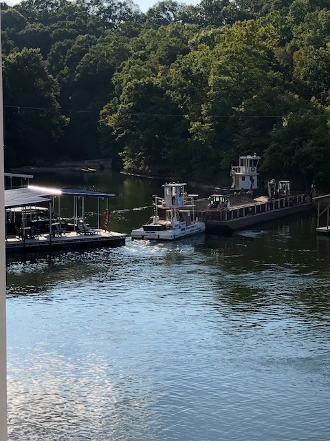
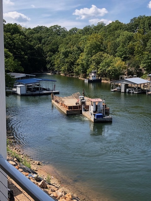
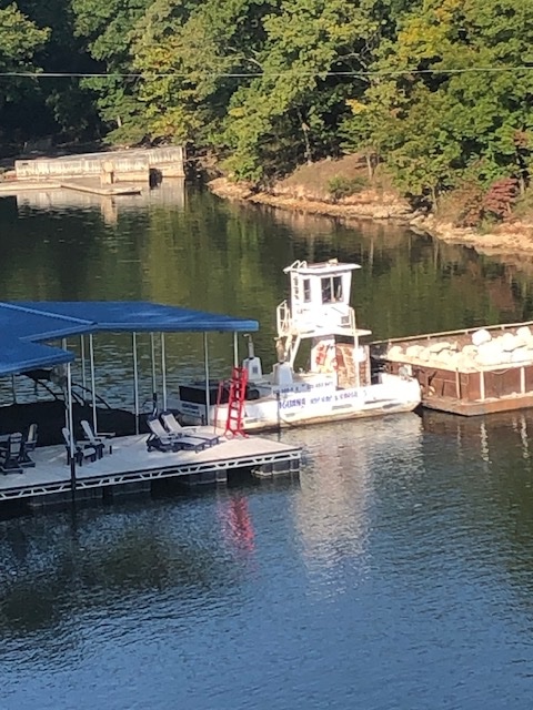
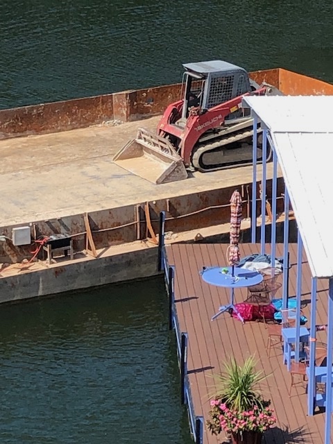
Ligouri explained that Pier 31 believes they own that piece of land. Rock Works is using the ramp to load its barges and run them out of the cove and onto the lake. The cove is narrow and Ligouri estimated that one of the barges was over eighty feet long. The cove is very crowded with docks on both sides. Ligouri said that Rock Works has hit several docks and even sank one of their barges in the cove. Ligouri felt that this barge activity is a major hazard with the crowded cove conditions.
Presiding Commissioner Skelton inquired if any reports had been made to the Water Patrol or Ameren?
Ligouri said they had reported it, but in his opinion, everyone was trying to push the responsibility for the situation onto someone else.
Ligouri stated that the trucking company bringing the materials to the barges has already run three people off the road and has been ticketed for that.
Commissioner Gohagan said that they had consulted with Donnie Snelling, the County Recorder, and he thought it would be best to engage with a third party to do a title search and give a legal opinion. They would use this third party to determine who does in fact own the property. Once the Commission determined the ownership, the Commission would schedule a future meeting.
Commissioner Skelton stressed that any safety issues in the water would be the responsibility of other agencies. David Krehbiel explained that the highway department had deeded the property to the county. Krehbiel remembered that when he was a commissioner, that road was a county road and they allowed neighbors to launch their boats off of that ground.
Commissioner Skelton asked what they would would want the Commission to do if it was determined that the county owned that portion of the road? Ligouri responded that they would want the county to close the road. He claimed that the road was no longer suitable for launching all but the smallest of boats.
Commissioner Skelton stated that the Commission would have to hire someone to investigate before they could make any decisions. The Commission was less interested in finding out if anyone was being paid for the use of the road and more focussed on its ownership. Krehbiel showed them his file and offered to provide those documents to the Commission so they could make copies.
Afterwards, I spoke to both of them. Ligouri offered to provide me with some photos of the barge operations to give a better idea of how close the barges are getting to the various docks in the cove. These photos were taken from the homes opposite the loading site.

When I talked to David Krehbiel, I learned that he is an avid reader of Among the Dogwoods! He used to be the County Surveyor and served on the Camden County Commission. He also might have saved someone’s life once or discovered a cure to something or other, but I can’t remember anything else because I was really trying to get him back to talking about his excellent taste in political writers.
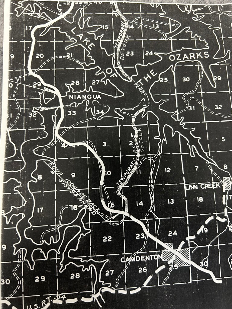
Krehbiel explained that this particular peninsula once served as the spot for a ferry and a swinging bridge across the Osage River. This helps to explain why some of the property used to be part of Old Highway 5.
It’s marked “Temporary Rt. 5” on the map below. In the map that Dave showed me, it looks like the ferry ran right out from where the Rock Works barges are loading:
According to Bill Moulder, a friend of mine, a swinging bridge went from Pier 31 to the end of F Road. The bridge was demolished when the dam was being built. He also sent me some pictures of the bridge.
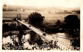
The above photo is looking north toward what is now Sunrise Beach. The hill in the background is the end of F Road.
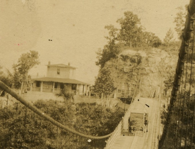
And this photo is looking at the toll house on the Linn Creek side. Bill said the lake level now would be halfway up that bluff.
So old Highway 5 ran along this bridge and it might ultimately play a role in determining the ownership of this disputed patch of road. That just shows why it’s important that we take good care of these old treasures from the past.
And I’m referring to the photos, not BIll. Though we should take good care of him too.
And that was that.

Th
LikeLike
Talk to David Krehbiel about his village. How he and a few others established their own villages while a mistake in the Missouri legislature was corrected. It’s a good story.
LikeLike
I think I’ve read a few news articles about that.
LikeLike